
Boundary and Topographic Surveys

COVID-19 Announcement:
*With the current state of a rising rural property market due to COVID-19, we have been trying our best to keep up with the surveying demand, but are notifying clients to expect delays.*
What We Do
Boundary Surveys:
Having access to survey records in Central New York dating to 1977, the personnel at R. Braun Surveyors are ready to bring their experience and expertise to your project. As successor in record to the files of Rowe, Woodin, Parsons, Kaatskill Mountain Surveyors, Gordon Sheret, L.S., Bartschi, Bartschi Mack, Ward J. Mack, and Mack and Lowes Assoc, we house thousands of files, detailing several thousand parcels of lands in Upstate New York.
Buying or Selling:
Land transfers benefit from an accurate and thorough boundary survey by ensuring that the buyers know what they are purchasing. The corners will be marked and the property lines flagged. Your lending institution and title insurer will receive the appropriate certifications. Your attorney will receive an accurate and up to date legal description.
Pre-Engineering Surveys:
A topographic and utility survey will provide a solid foundation for building and development projects. Engineers and architects will use the survey for building and utility design. Drainage and sanitary structures are plotted for design use, ensuring proper flow and drainage.
Land Disputes:
While no one wants hard feelings with their neighbors, a boundary survey is a necessary step in the resolution process. Our considerate and tactful staff are able to provide you the testimony you may need.
Deed Research:
An integral part of the survey process is the courthouse research. This involves the exploration of the historic land records associated with both the surveyed property and the adjoining properties.
Sub-division of Land:
Our staff is experienced in the mapping, layout and approval process of land subdivision. Whether a simple lot split or large development we can provide you with timely and complete mapping.

Why?
Dream it.
Trying to figure out where you are and where you're going is probably one of man's oldest pastimes.
Build it.
Navigation and positioning are crucial to so many activities and yet the process has always been quite cumbersome.
Grow it.
Over the years all kinds of technologies have tried to simplify the task but every one has had some disadvantage.
Launch it.
Finally, the U.S. Department of Defense decided that the military had to have a super precise form of worldwide positioning.

The result is the Global Positioning System, a system that's changed navigation forever.
How We Do It
Equipment & Techniques
NYSAPLS: R. Braun Surveyors follows the Code of Practice for Land Surveyors.
Having operated Lieca, Trimble, and Spectra Precision Global Positioning equipment since 1995, R. Braun Surveyors personnel have earned a reputation for accurate results and on-time delivery.
*With the current state of a rising rural property market due to COVID 19, we have been trying our best to keep up with the surveying demand, but are notifying clients to expect delays.*
GPS Pre-engineering Control - Precise Coordinates and Elevations in the State Plane Coordinate System.
Real Time Mapping - Cost effective observations for wet-land delineation, GIS systems and aerial mapping control networks.
GPS Land Surveying provides one of the most modern and up to date surveying techniques available. This equipment has been designed to give the performance in accuracy and reliability that the survey and construction industry demands.
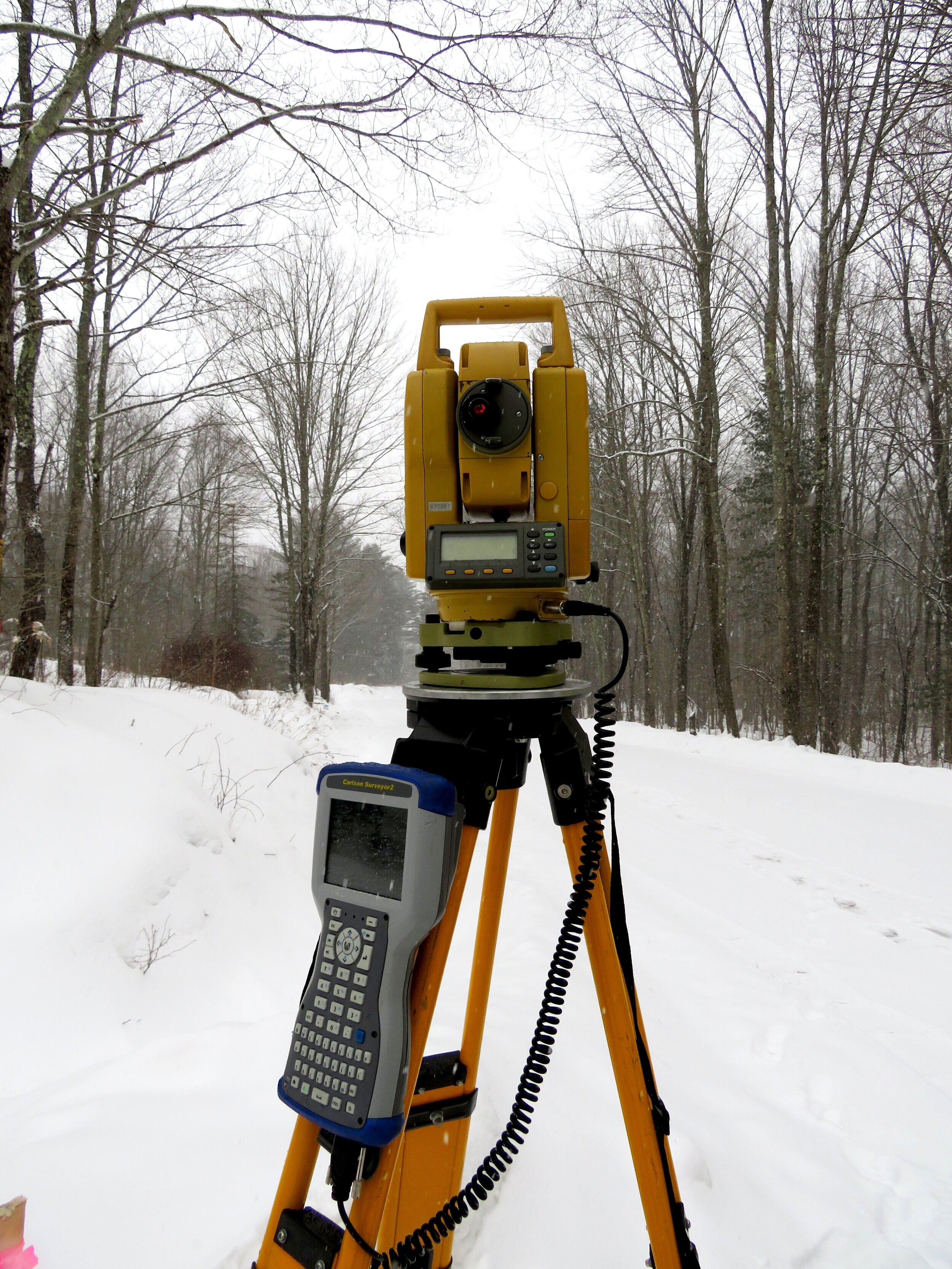
R. Braun Surveyors uses the International GPS Network to obtain accurate positions in the state plane coordinate system. Traditional measurement techniques still share a prominent role in the survey industry. Vegetative cover often precludes satellite visibility and the use of standard theodolite instruments is required.

Surveying is Necessary:
*A complete and accurate land survey is of fundamental importance in nearly all real estate transfers. A comprehensive land survey and physical inspection of the property is the only efficient and reliable means of delineating the physical limits of the property and locating the improvements on it. Yet land surveys are one of the least understood and most frequently overlooked elements in a real estate transaction.
Here are five fundamental reasons for requiring land surveys in real estate transactions:
1. Existence of the Property
2. Relationship of the Property to Adjoining Properties
3. Relationship of Occupied Lines to Record Lines
4. Location of Physical Improvements
5. Unrecorded Easements and Other Facts not Recorded
* Parts of this section were copied from: Land Surveys, A Guide for Lawyers, 1987, "Real Property Division", Real Property, Probate, and Trust Law Section American Bar Association
Authors: Mitchell G. Williams and Harlan J. Onsrud